Mostrar el registro sencillo del ítem
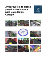
Anteproyecto de diseño y costos de cicloruta para la ciudad de Cartago
| dc.contributor.advisor | Ugalde, Carlos | es |
| dc.contributor.author | Espinoza-Espinoza, Carlos Roberto | |
| dc.date.accessioned | 2015-08-20T21:12:05Z | |
| dc.date.available | 2015-08-20T21:12:05Z | |
| dc.date.issued | 2011 | |
| dc.identifier.uri | https://hdl.handle.net/2238/6214 | |
| dc.description | Proyecto de Graduación (Licenciatura en Ingeniería en Construcción) Instituto Tecnológico de Costa Rica, Escuela de Ingeniería en Construcción, 2011. | es |
| dc.description.abstract | This document contains the tools and procedures used in developing a preliminary design and cost of a bike path in the city of Cartago, It aims to provide the municipality a draft and a proposal for an unique or exclusive infrastructure for cyclists containing geometric design, planimetry and height profiles, complemented by 3-pavement structure alternatives and specific cross sections for each of the 7 sections that make up the bike path. The proposed route runs through the center and the peripheries of the city and connects many important points of the city such as schools, parks, central market, amongs others it has elements of protection, vertical markings and signs to increase safety for users. It is hoped that this work is the basis on which developers can begin the project with the design, planning and execution of works, is not intended as the final design since in reality arise modifications due to the presence of special conditions along the path, but provides an adequate approximation of what should be done. It used aerial images provided by the municipality as well as two orthophotos Ochomogo and Tejar to carry out the project axis plot and determining the height profile along the same; design manuals were consulted for this type of infrastructure used in South America and based on AASHTO and conducted a survey of information and photographs along the path. We obtained a two-way bike path 3 m wide and a length of about 12 km, which is two circuits one in the north and another in the south are united in the 6th Avenue in the heart of the city. | es |
| dc.description.sponsorship | Instituto Tecnológico de Costa Rica. Escuela de Ingeniería en Construcción | es |
| dc.language.iso | es | es |
| dc.publisher | Instituto Tecnológico de Costa Rica | es |
| dc.rights | acceso abierto | es |
| dc.subject | Diseño Planimétrico | es |
| dc.subject | Señalización | es |
| dc.subject | Demarcación | es |
| dc.subject | Seguridad Vial | es |
| dc.subject | Ciclobanda | es |
| dc.title | Anteproyecto de diseño y costos de cicloruta para la ciudad de Cartago | es |
| dc.type | tesis de licenciatura | es |


